Plan Your Visit: How to Find The Citadel
The Citadel is located in the heart of historic Charleston, South Carolina. Whether you’re arriving by car or from the airport, we’ve made getting here simple. Below are directions based on your point of entry.
Directions – From Interstate 26 Eastbound
- Take exit 219-A for Rutledge Avenue
- Continue on Rutledge Avenue for 1.2 miles
- Turn right onto Moultrie Street
- Follow Moultrie Street until it ends at Lesesne Gate, the main entrance to campus
Directions – From Interstate 26 Eastbound
- Start on International Blvd
- Turn left onto West Montague Ave
- Merge onto I-26 Eastbound
- Take exit 219-A for Rutledge Avenue
- Follow Rutledge Avenue for 1.2 miles
- Turn right onto Moultrie Street
- Follow Moultrie Street to Lesesne Gate
Directions – From US 17 Southbound (coming from Mount Pleasant)
- After crossing the Ravenel Bridge, continue on U.S. 17 South
- Turn right onto Hagood Avenue (at McDonald’s)
- Continue past the football stadium and enter campus via Hagood Gate
- If Hagood Gate is closed:
- Turn right onto Huger Street
- Turn left onto Elmwood Street
- Turn left again after one block to enter through Lesesne Gate
Directions – From US-17 Northbound (coming from West Ashley)
- After crossing the Ashley River Bridge (and passing the round Holiday Inn), stay in the left lane of the exit ramp
- Turn left at the light onto Lockwood Drive
- After 0.5 miles, turn right onto Fishburne Street (just before the baseball park)
- Continue 0.3 miles, then left at the stop sign onto Hagood Avenue
- Follow Hagood Avenue past the football stadium to enter via Hagood Gate
- If Hagood Gate is closed, follow alternate directions above to enter via Lesesne Gate
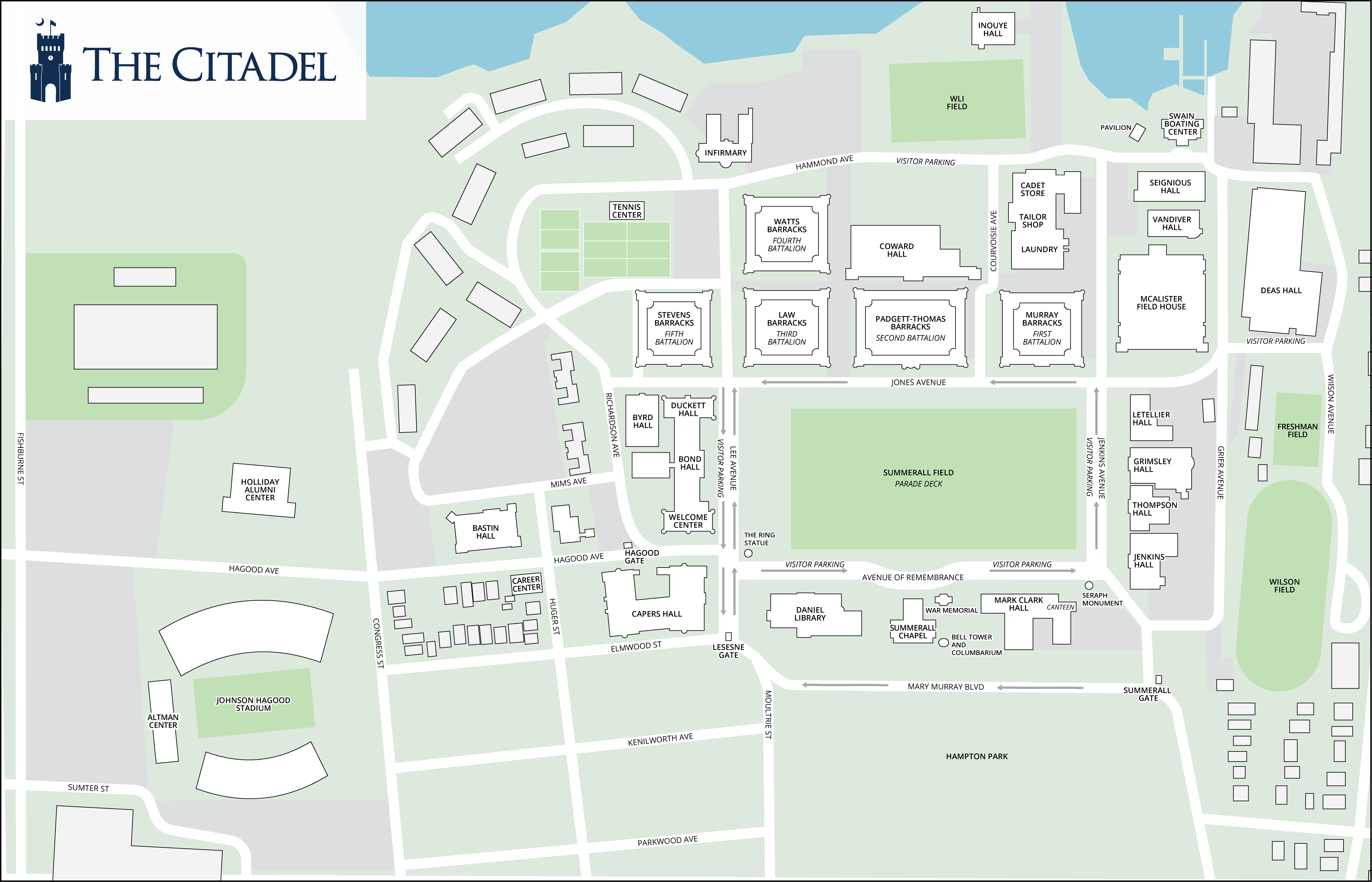
Campus Maps & Resources
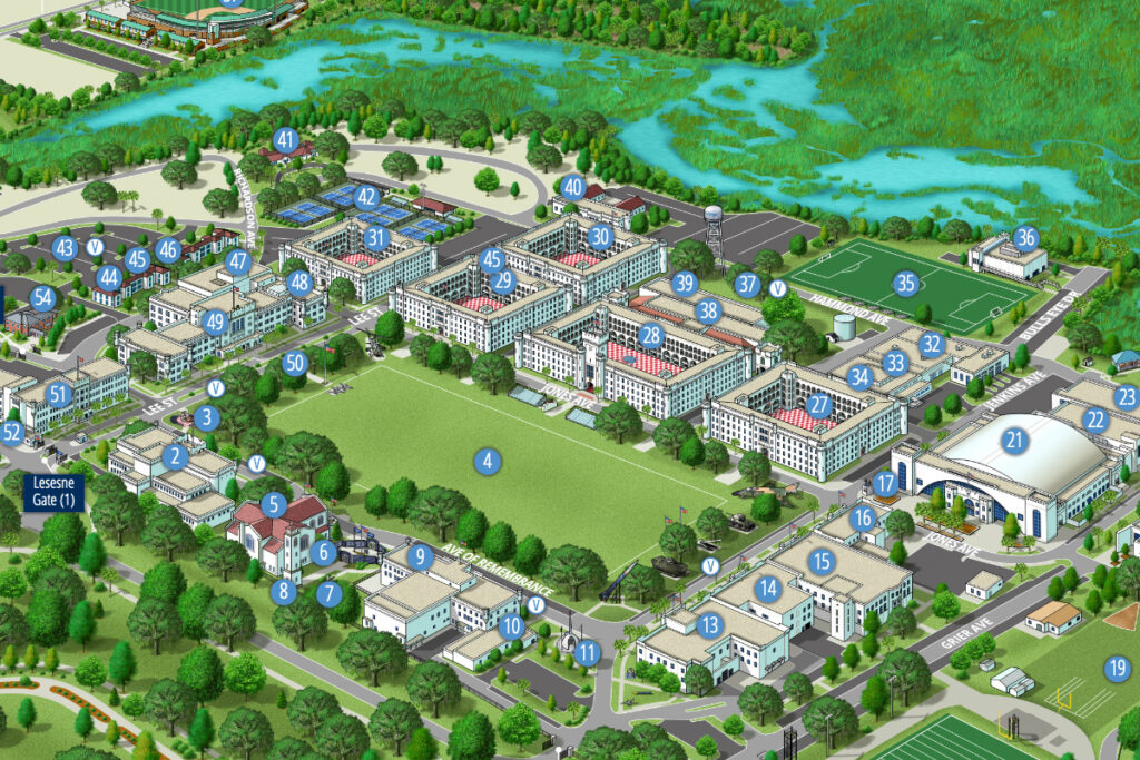
Additional Maps
Click any map below to enlarge:
The Citadel Campus
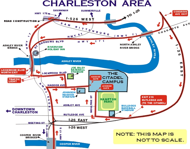
The Citadel and the Surrounding Neighborhood